It’s been a long time coming! Wow & Finally….are the only two words that come to mind! Big Falls on the Thompson River has been the #1 waterfall on my “Waterfalls to See” list for years now. Early on, I got High Falls at DuPont, Rainbow Falls in Gorges, and Whitewater Falls off the list pretty quick. These seemed to be some of the big waterfalls in North Carolina that newbies can all get checked off pretty easy. Big Falls on the Thompson is a different story. The difficulty goes up several notches. Back then, and still these days, I relied heavily on Waterfall Rich’s site www.ncwaterfalls.com. If you scroll down his impressive list of waterfalls to the one for Big Falls, it is clear that not only is this one of his favorite waterfalls, but also that the trek there is NOT to be taken lightly. It is long. It is steep. It is potentially dangerous. There are river crossings that must made. Me being primarily a solo hiker and photographer for years, I have kept putting this one off. I have always planned on going , but reading Rich’s report, this trip was not going to be made until conditions were optimal. Optimal conditions and open availability rarely seem to happen at the same time.
Well, timewarp ahead to the summer of 2015. I was already on a tear this year seeing new waterfalls in North & South Carolina, Virgina & West Virginia, as well as an impressive list in Tennessee. Still, no Big Falls on the Thompson. Then back in July, on an otherwise excellent waterfall day, I take a fall on an easy, routine hike, tripping on some roots on my way to Cedar Rock Falls. My knee is sprained with even a slight fracture to the tibia, and sidelined 4-6 weeks. I snuck out for a few easy hikes, but was clearly limited. It was then that my hiking habits changed. After chatting with well-known waterfaller Mark Lackey, who was planning an intense week of waterfalls in August, we arranged a hike in the Wilson Creek area. It was there that I met other Waterfallers that I knew of only online as well: Beth Bradshaw, Stephanie Leigh, Jack Buchanan, Daniel Jack Hutchinson (w/bones), and Mary Gavlik. Since then, I have been on a number of hikes with these guys. The line-up of folks changes some each time, but the core has been the same. After some truly epic hikes to places like Mooneshine Falls, South Harper Creek Falls, North Harper Creek Falls, Bard Falls, Pearsons Falls, and a full day in the Green River Gamelands, that included Big and Little Bradley Falls and numerous unnamed falls, the opportunity that I have been waiting for became available. The crew was planning a trip to Big Falls on the Thompson River on September 19. I could barely contain myself.
Unfortunately,…. I could not go. I had plans that weekend to a football game in Knoxville, TN to see the Tennessee Volunteers take on the Western Carolina Catamounts with my family in the impressive “Sea Of Orange”, known as Neyland Stadium, along with the 102,000 other fans. While I had a blast there, I was still sad to have missed this rare opportunity. Well,lucky for me, sometimes things work out certain ways for reasons we can not explain. Beth Bradshaw, was planning on going back to Big Falls, for a 2nd weekend in a row, this time with Mark Lackey, who missed the week before as well. I was offered a 2nd chance and did not hesitate. Big Falls was on for Sunday 9/27/15.
The weather was a concern for this day. After 2 days of rain, drizzle, and fog, the trail was certain to be messy. The river crossing was a concern as well, remembering what I had read from Rich’s description. They said the conditions were nothing like the hike a week prior when it was warm, with bright sunshine, and low water. I shared these concerns with Beth, and we decided we would hike to the river crossing, then determine if it was safe to continue on.
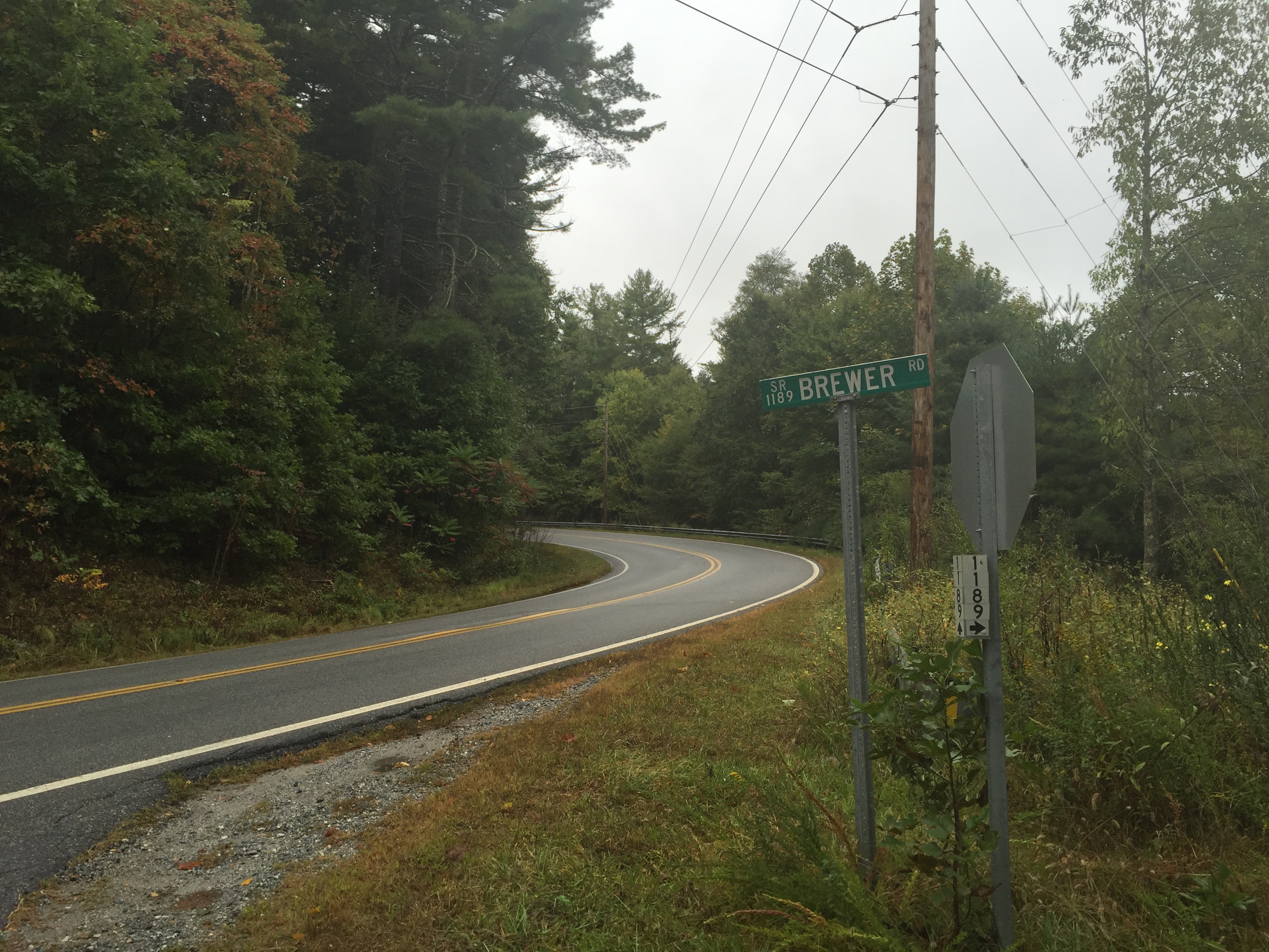
The trail for to Big Falls starts right off of NC 281, about a mile or so, south of The Gorges State Park entrance. It is also several miles north of Whitewater Falls. The picture above showing Brewer Rd is the parking area and the trail head. This is also the same place to park to see some other favorites of mine: White Owl Falls, and High Falls. I have stopped here several times for the short walk down the road and over the guardrail to White Owl Falls. This would be only my second trip heading up this old logging road though. The last time was a shorter trip to a pretty impressive High Falls.
As we headed off, I couldn’t help but think about the river crossing ahead. The water was going to at least be above normal. Also, it was quite cool outside with the the temperature in the high 50’s with gray skies and drizzle. It wasn’t THE day to be getting in the river. As it would turn out, we were quite fortunate. The trip went on with only a few brief, light showers, while other parts of NC were getting pounded with rain from Asheville on east. This would have made this particular trip impossible. Back on the trail and just before we got down to the turn off for High Falls on the right, there was a turn off on the left for a smaller 20 foot waterfall, called the Waterfall on Reid Branch. I had skipped this on my last hike here, but today seemed to be a good day to stop as it was making a lot of noise from down below. The hike was still early, as we were still really just getting started. Mark and Beth were more than happy to make the short, but somewhat steep side detour. 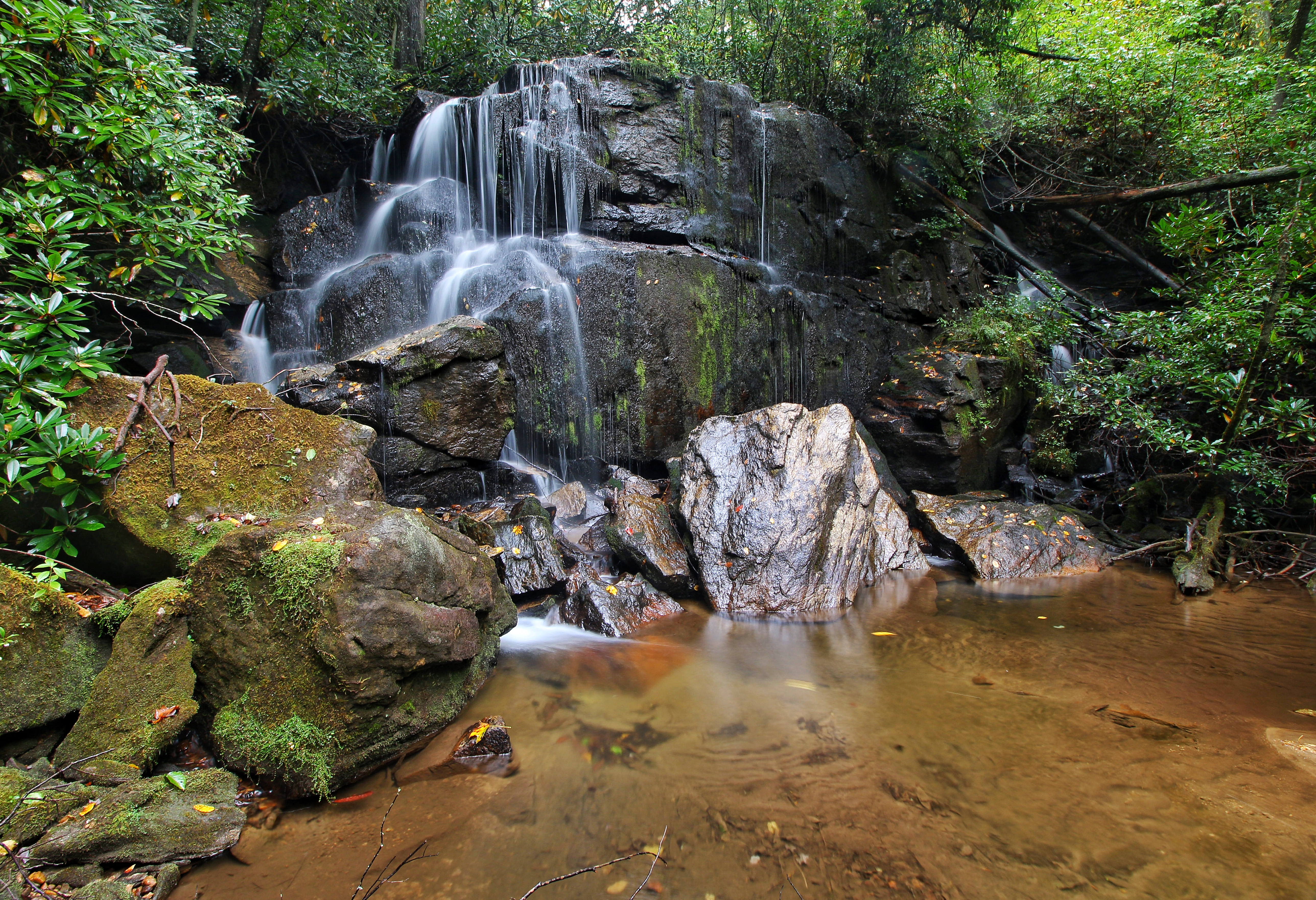
The trip down was a little tricky. Make sure and look for the pink flagging tape that roughly marks the makeshift trail. If you have any doubts or difficulty on this trail, please consider NOT proceeding to Big Falls. Once down to the waterfall, the view was very nice. This being my first visit, I believe the rains of the previous 2 days made this look better than it typically would. The photo makes it seem open at the base, however, large fallen trees at the base and across the trail made moving around down there somewhat of a challenge.
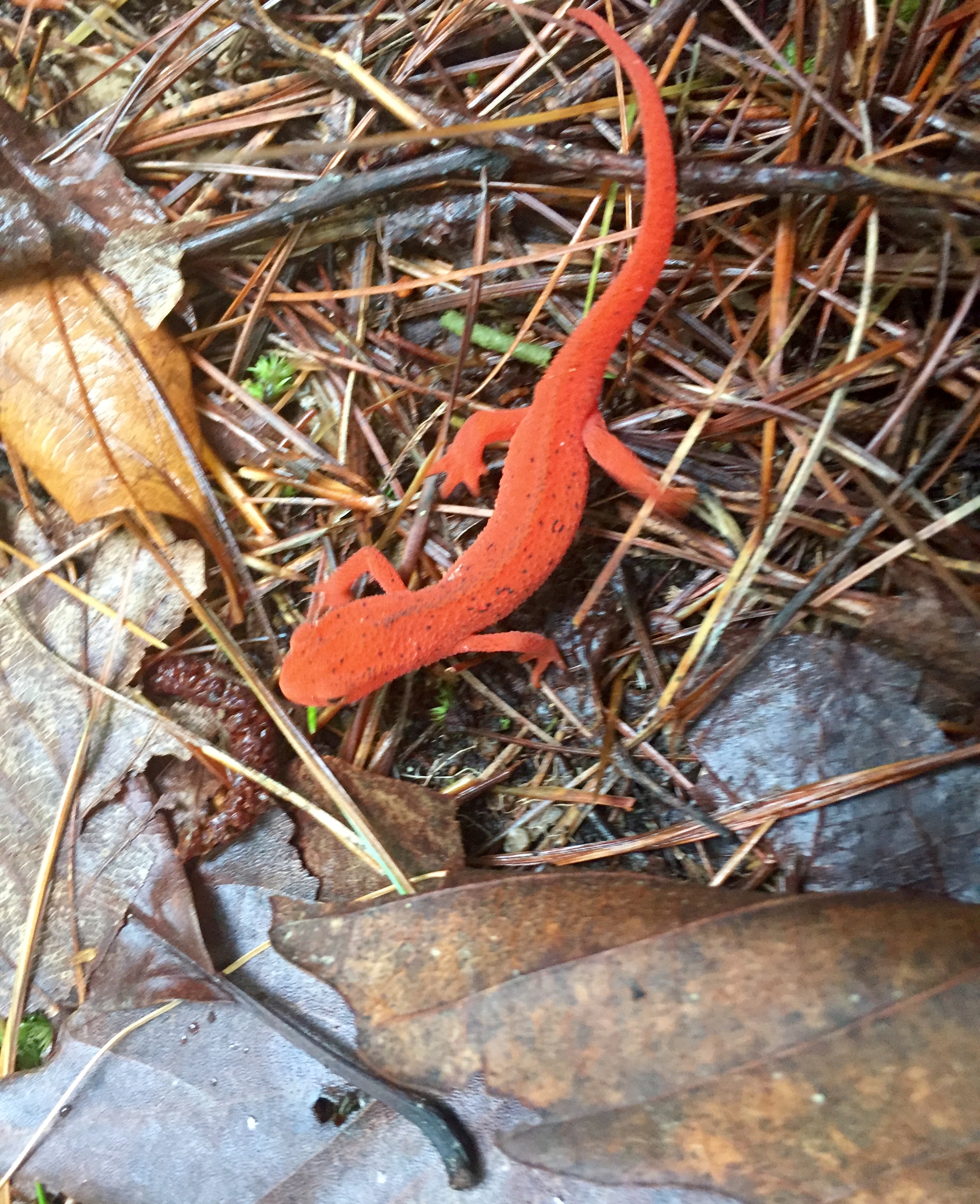
Once back on the main trail, the turn off for High Falls is soon coming. This is as far as I made it the first time I was on this trail, which is in very good shape for an unofficial trail, btw. It is definitely worth taking the side trip to High Falls but…we were focused on Big Falls and had just taken one side trip. So, we skipped it and once past the intersection for High Falls, the trail descended a tad around some switch backs. It was in this area that a pretty cool campsite is set up, with a spatula even provided…lol. We also came accros this little guy, a red spotted Newt I believe. 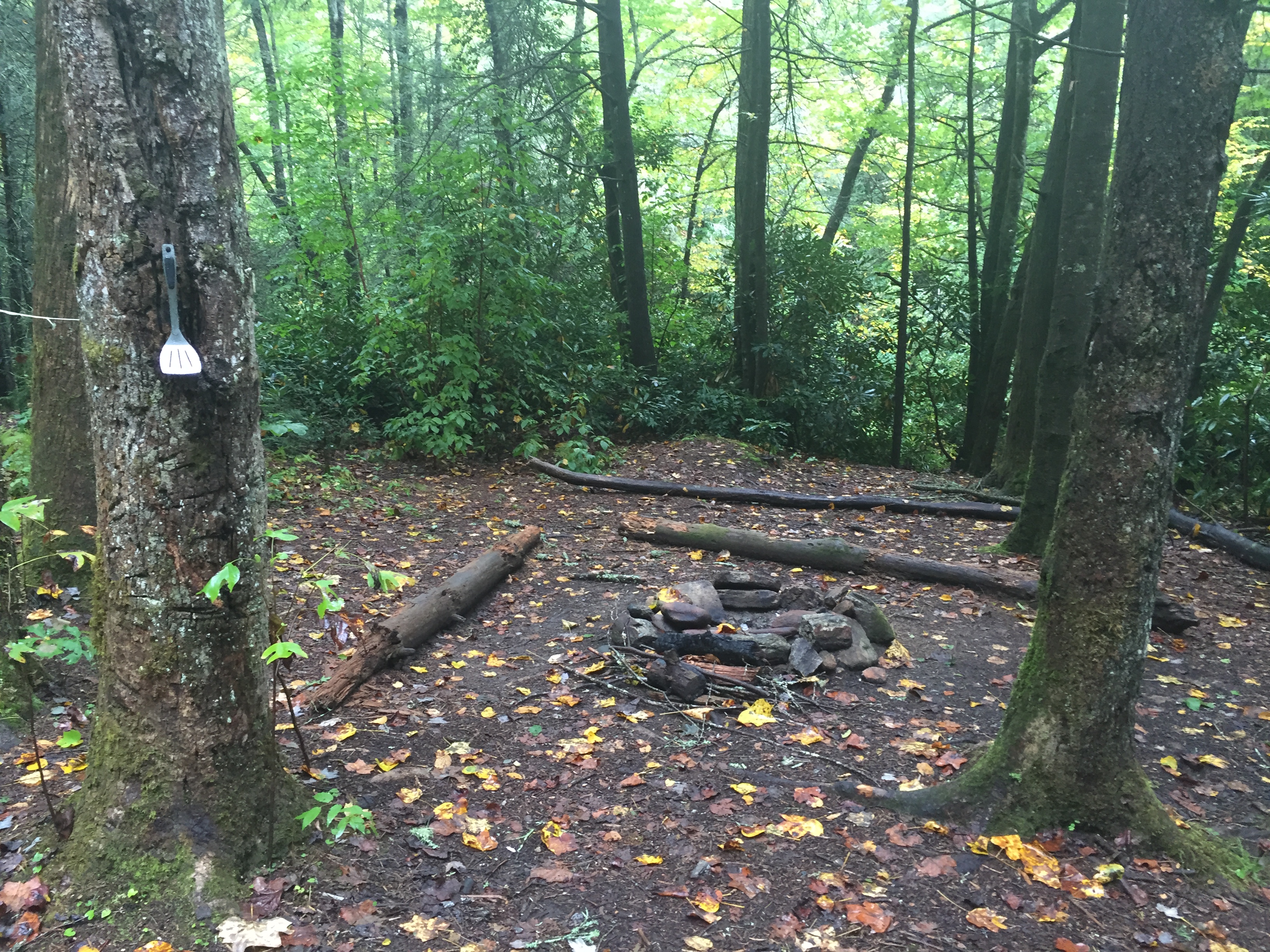
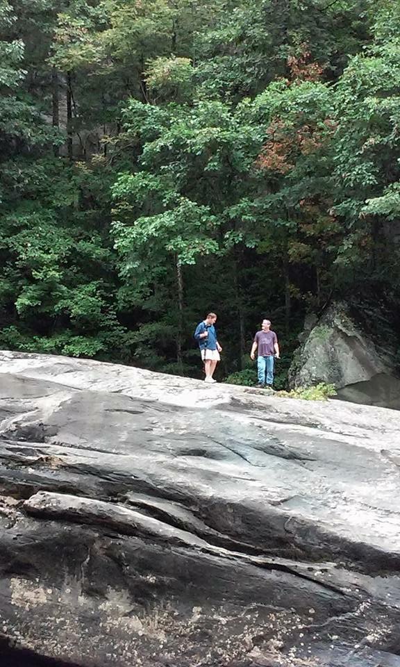
Just a little further, then came the first view of the Thompson River. Until now, the first mile and a half or so, the river has been on the right side of the trail over a ridge, out of sight, out of sound. From the crossing on, the Thompson will be seen only a little, but heard a lot, flowing on the left side of the trail, at different elevations above the river with numerous drops and cascades. Here is the first view of the Thompson, with Mark and Beth ahead of me crossing.
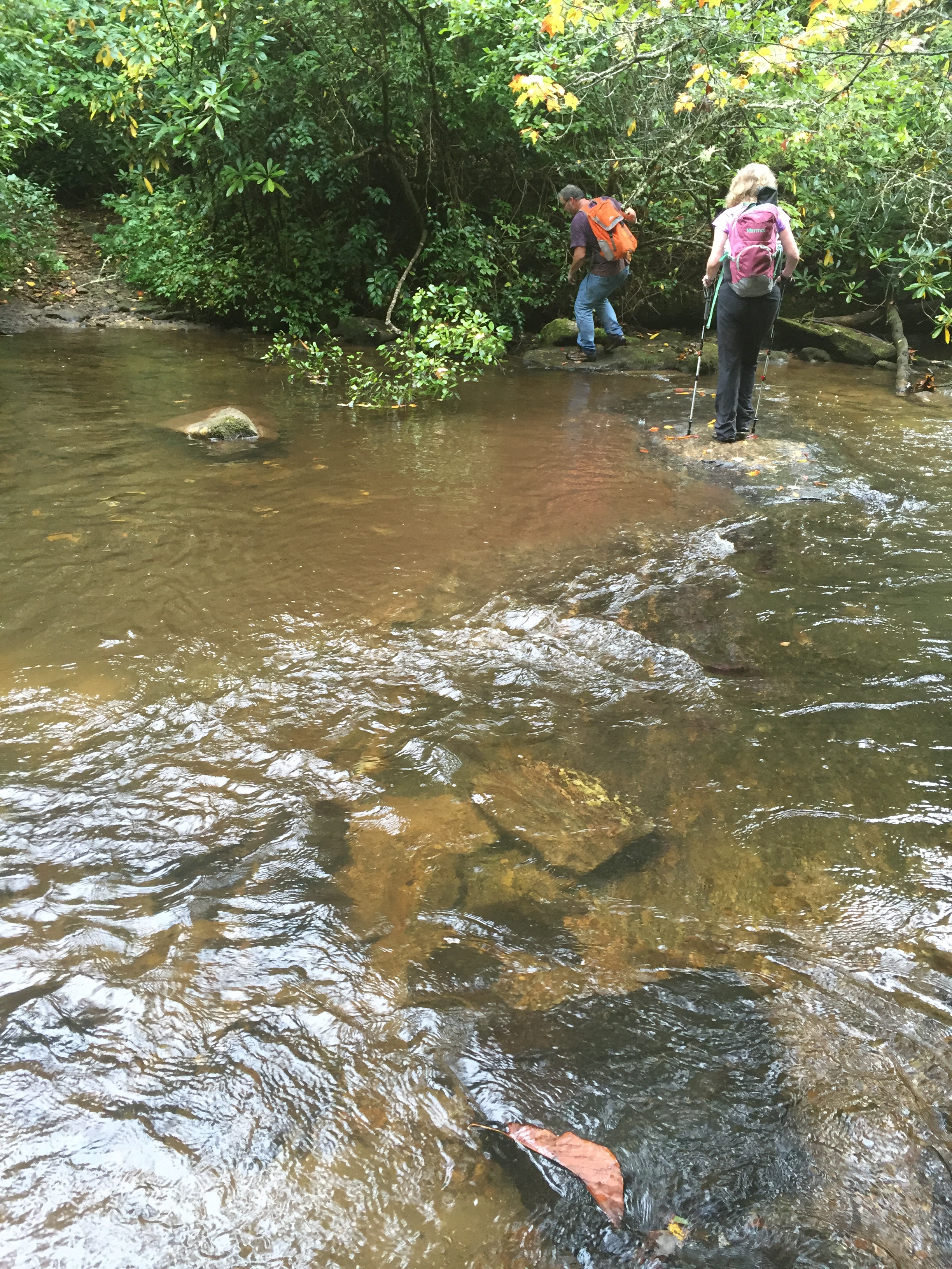
The river was somewhat wide here and the water was up, but certainly nothing that would be considered unsafe. A week prior, Beth said that they were able to make this crossing dry, to give a good water level comparison. So on we marched, on the 2nd half of the hike. The road until now has been mostly level or at a slight decline. It has been a pretty easy stroll except the crossing and the short climb down to Reid Branch. This entire road is also littered with side trails that go to other waterfalls. There are a number of what seem to be “recently” fallen trees that made us old folks bend and stretch some to get under and around. With all the side trails and noisy falls heard way down from the trail, I was very thankful to be making this hike with 2 people who have previously done this hike. I could see people getting lost, or just simply never finding Big Falls, without the experienced guidance.
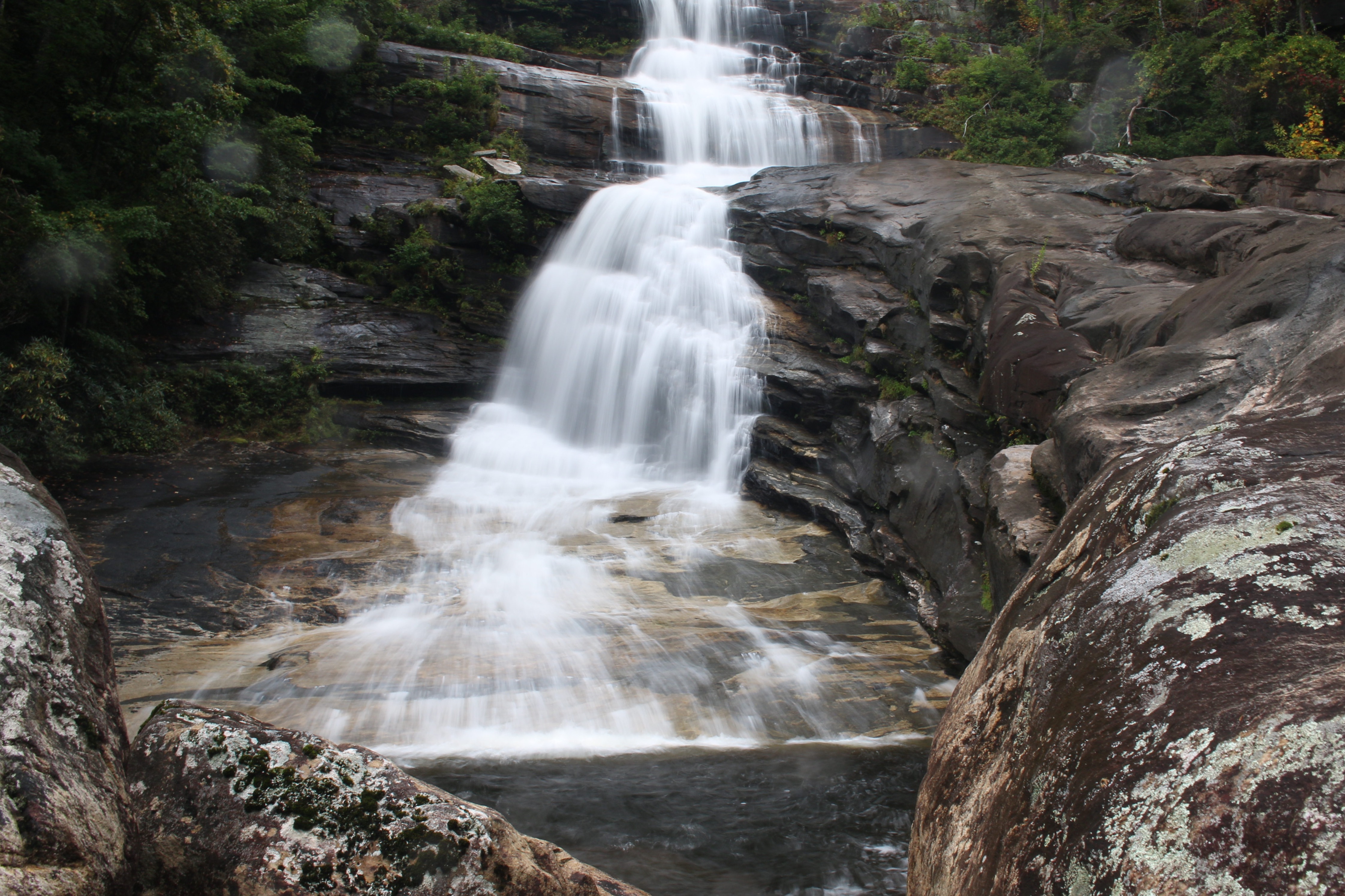
Waterfalls begin appearing just downstream from the crossing and there are at least 3 significant waterfalls between here and Big Falls that I know of, known as Waterfall #1, #2, and #3. #2 is now also known as Rich’s Falls, named after..Waterfall Rich. I’m sure there are also plenty of smaller, interesting cascades as well. None of this mattered to me on this day though as it was all about Big Falls. We skipped them all and finally, came up on the intersection of the side trail heading left and down to Big Falls. It is currently marked by a hiking stick, flagging tape and a small rock cairn. It is in the neighborhood of 3 miles from NC 281.
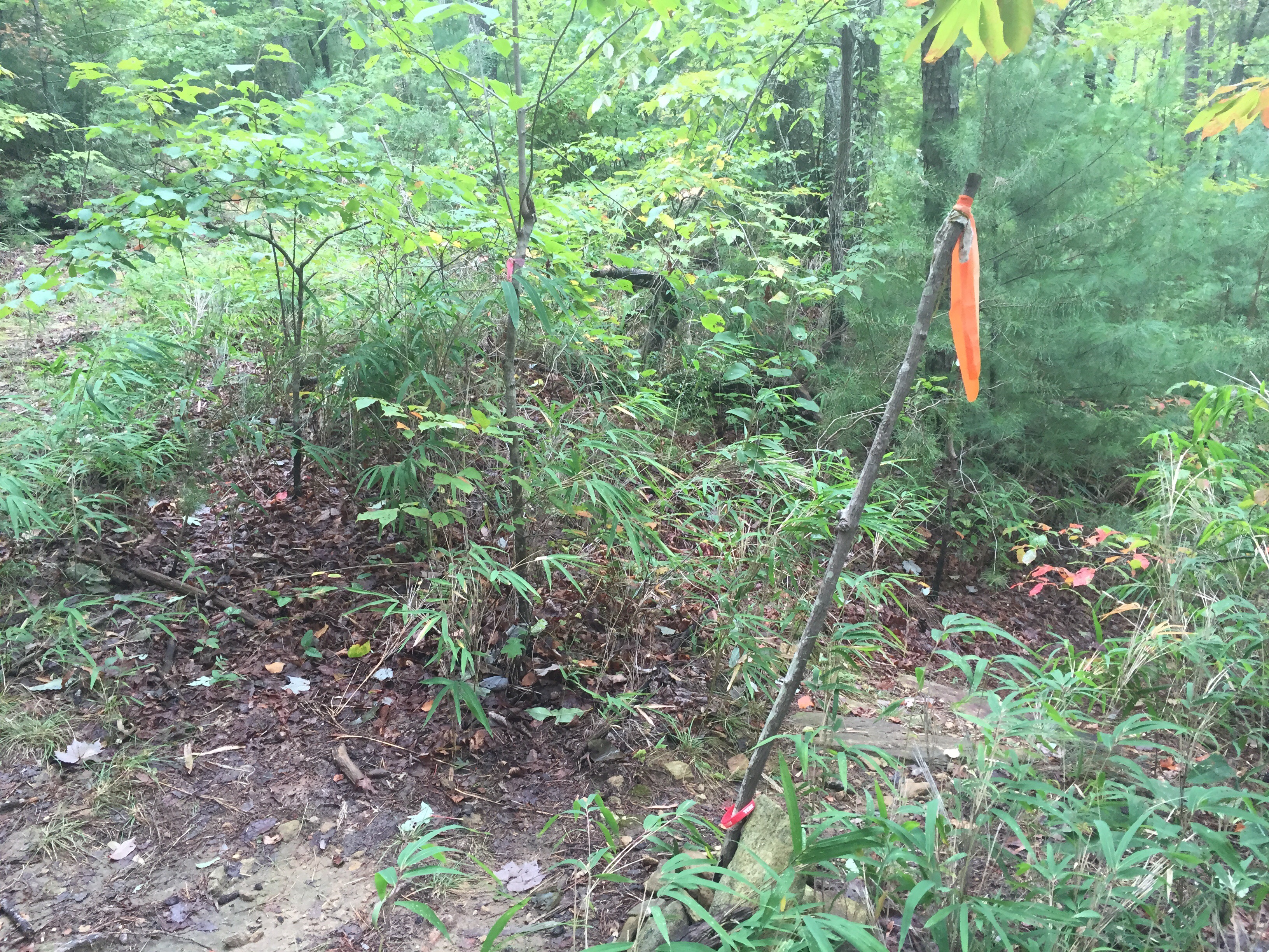
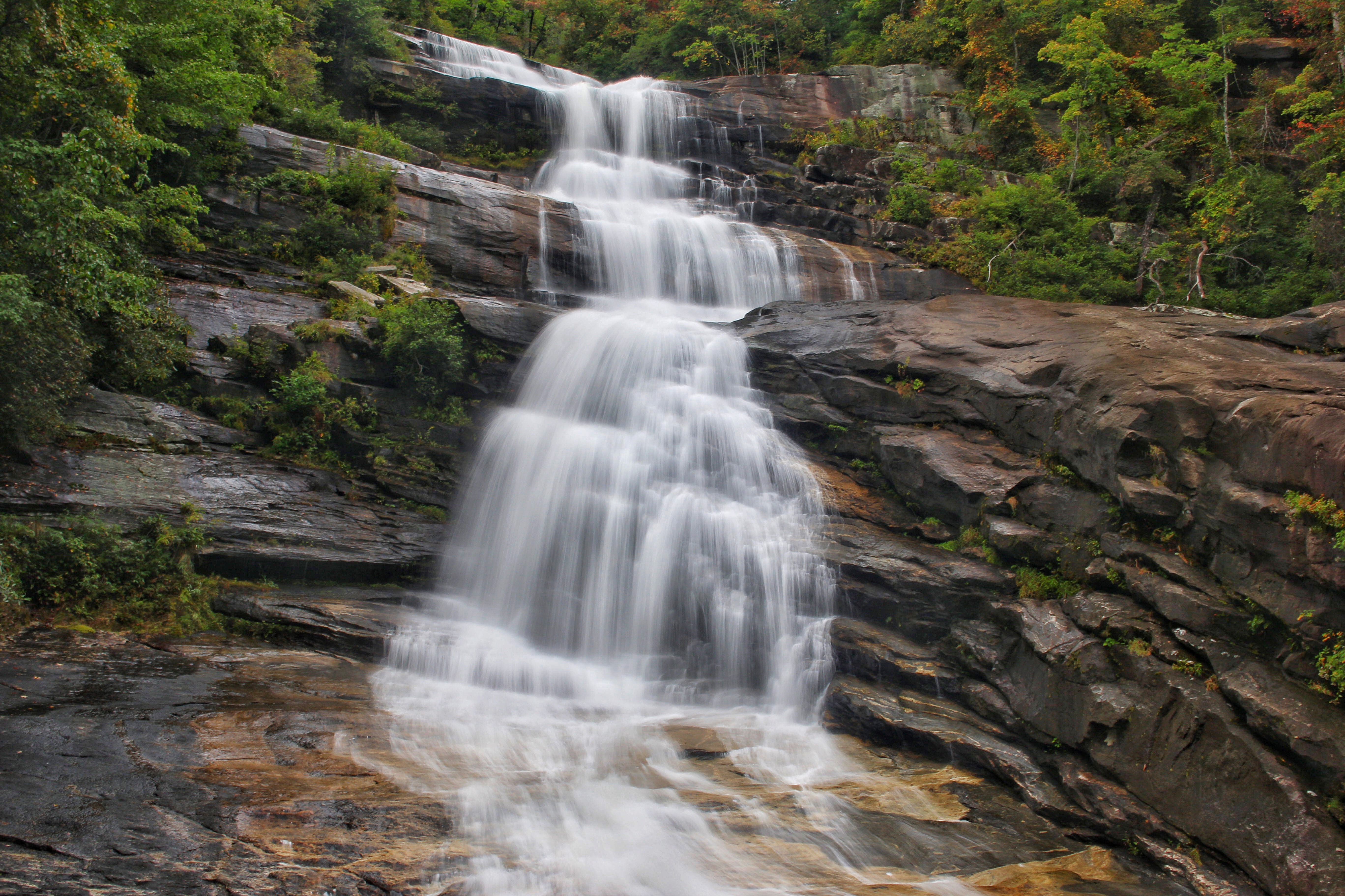
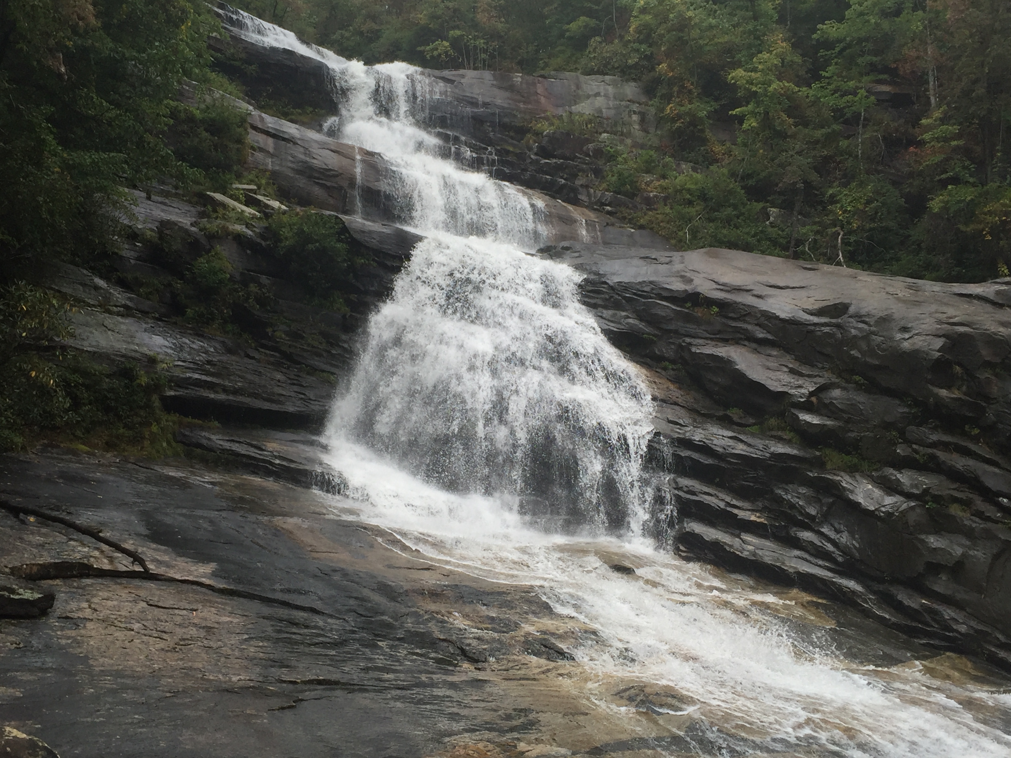
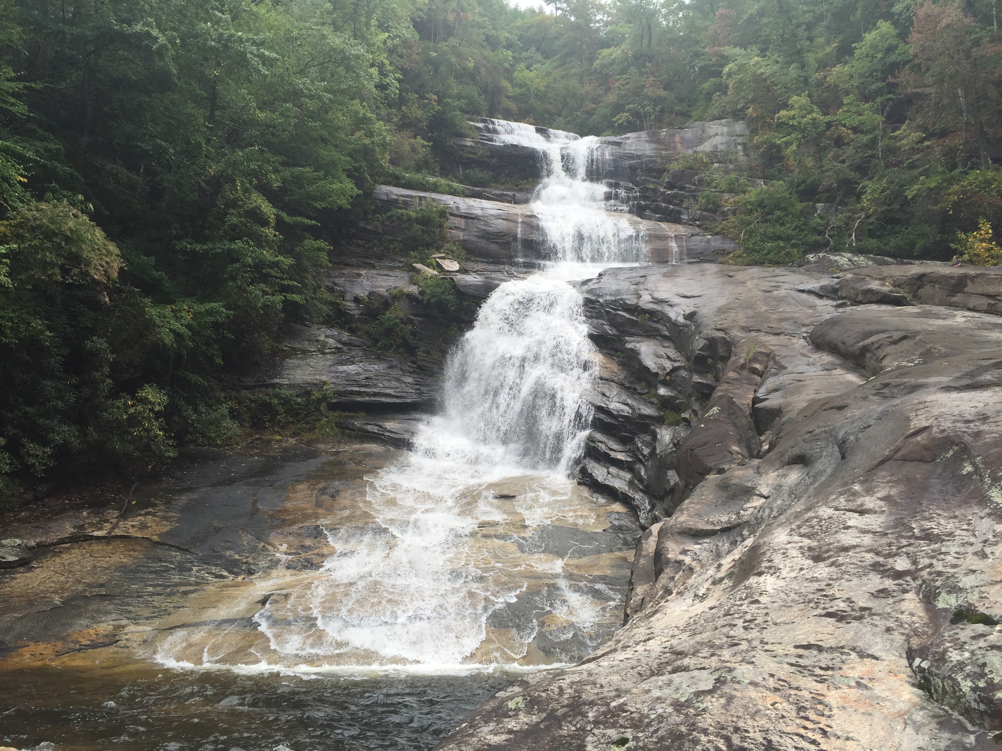
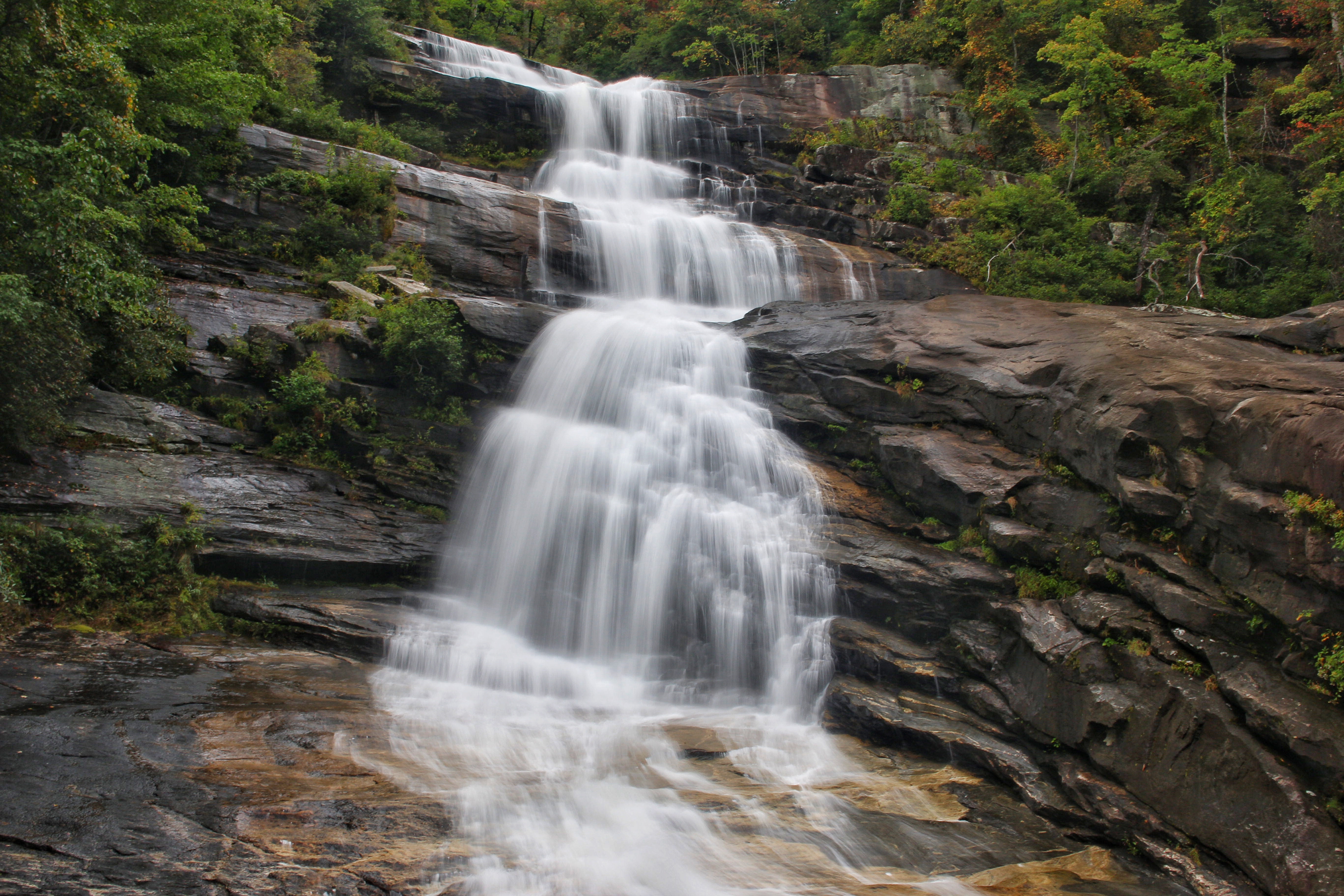
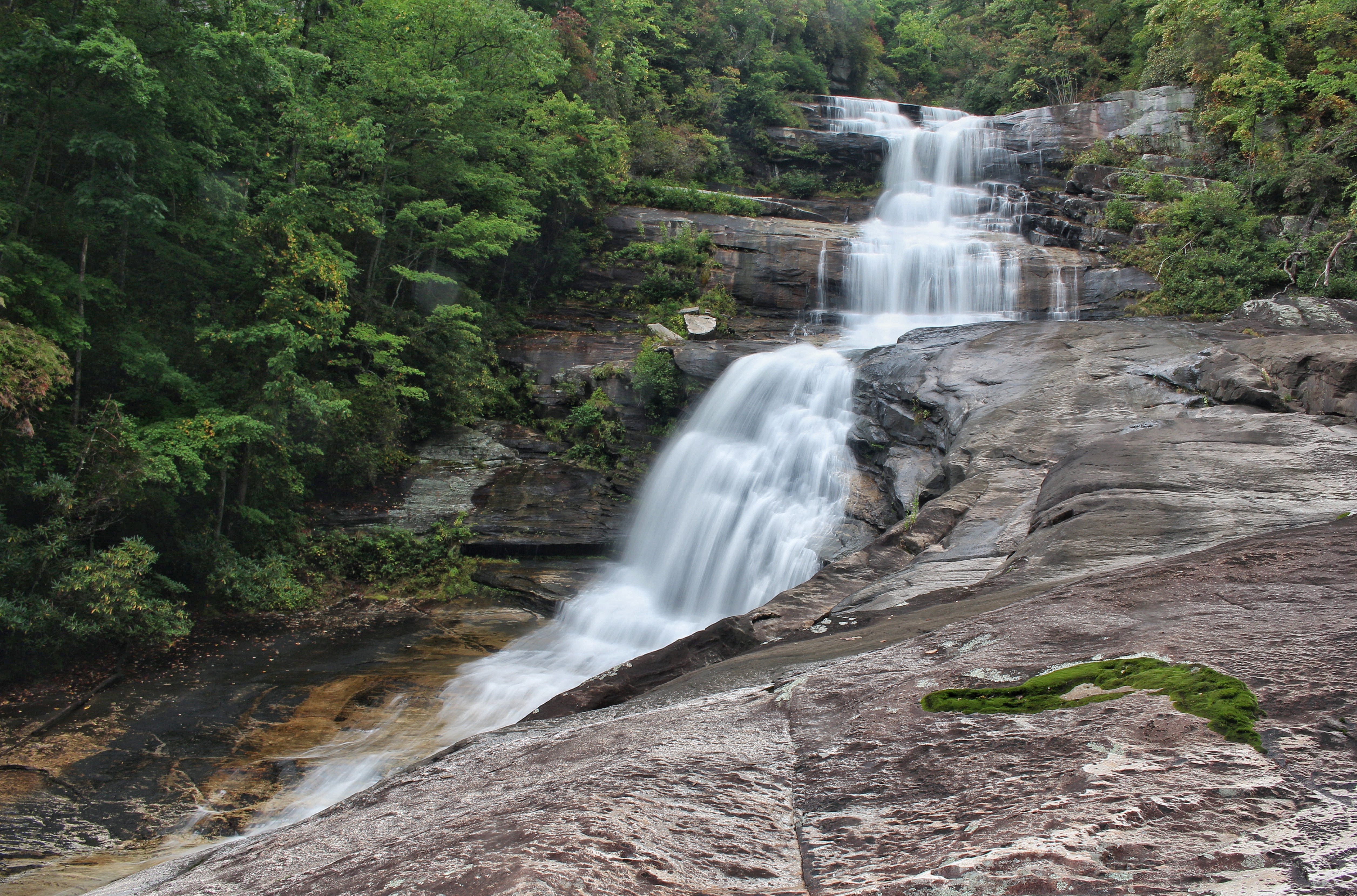
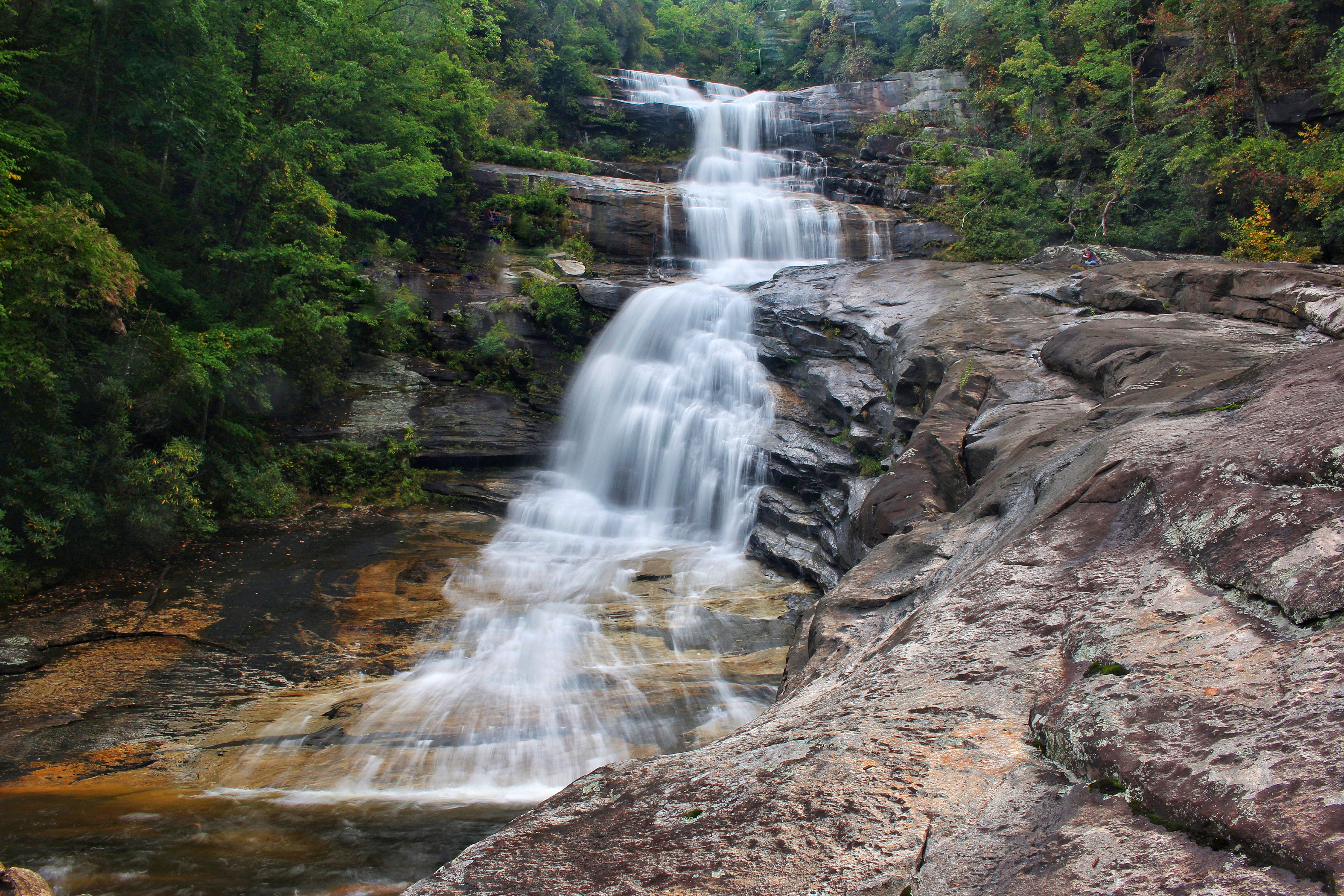
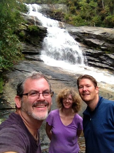
If this stick wasn’t here, or if Beth hadn’t just been here a week ago, this side trail would be very easy to walk right past. I have heard stories of this happening, and the waterfall not being found. At this point, you are so far above Big Falls that it can’t really even be heard, certainly not enough to distinguish them from any other cascade. The terrain is fairly level as well here, HOWEVER….this is where the easy to moderate stroll becomes steep and strenuous. Before it got tough, I had a brief encounter with some extreme briars that made some intense, deep scratches on my right leg. It didn’t matter. We had come way too far to worry about a few scratches and on we went. This trail for next 1/3 of a mile or so, changes fast from near level, to moderate, to steep, to rope assisted climbing. There were at least 10 short ropes in place to help the near vertical descent in places down the mostly dirt trail. All were in good shape except one that was slightly frayed. There are also some trees, rhododendron and rocks to hold onto along with the ropes for stability. I can’t stress this next part enough…..Do not be in a hurry on this stretch. It could end badly. I don’t usually make strong statements like that so please take notice. It is safe if you are mobile, and take your time, and descend careful and strategically. A large rock must be navigated down and through towards the ends of the steepest section, again rope assisted. After this, the Thompson River is in sight, just down below. Big Falls is just upstream, still out of sight, but definitely making some serious noise. Once the trail makes it to near the river level, I would love to say that you have made it….but there is still some fairly intense bushwhacking upstream through some thick fallen trees and rocks, and low rhododendrons. While Mark found his own way off trail, Beth led me through some tight fallen trees and thick rhododendron that just about got me stuck. She is also about 1/4 of my size and did not have near the difficulty that I did here. On the way back I refused to go back that way and found an easier path by just going up a little then coming back down. The trail finally spits you out into the relatively small pool below Big Falls. Before I could even think to enjoy this, I needed several moments to rest and recover from what was the most intense decline that I have ever made. Mark, the seasoned climber, had already rock hopped into the middle of the Thompson and was capturing images. It was gray & cloudy, with light winds and the waterfall was just amazing! The conditions were pristine! It looks sooooo much different in person than it does in any photo that I have seen. 125 feet coming straight down over a series of falls with a very large, somewhat flat rock running up the right side. Getting over there, required another river crossing in nearly knee deep water then some rock hopping . I found a safe place to cross and worked my way up on the rock to join Mark. It was so worth it for the views that awaited. Here are some shots from my Iphone.
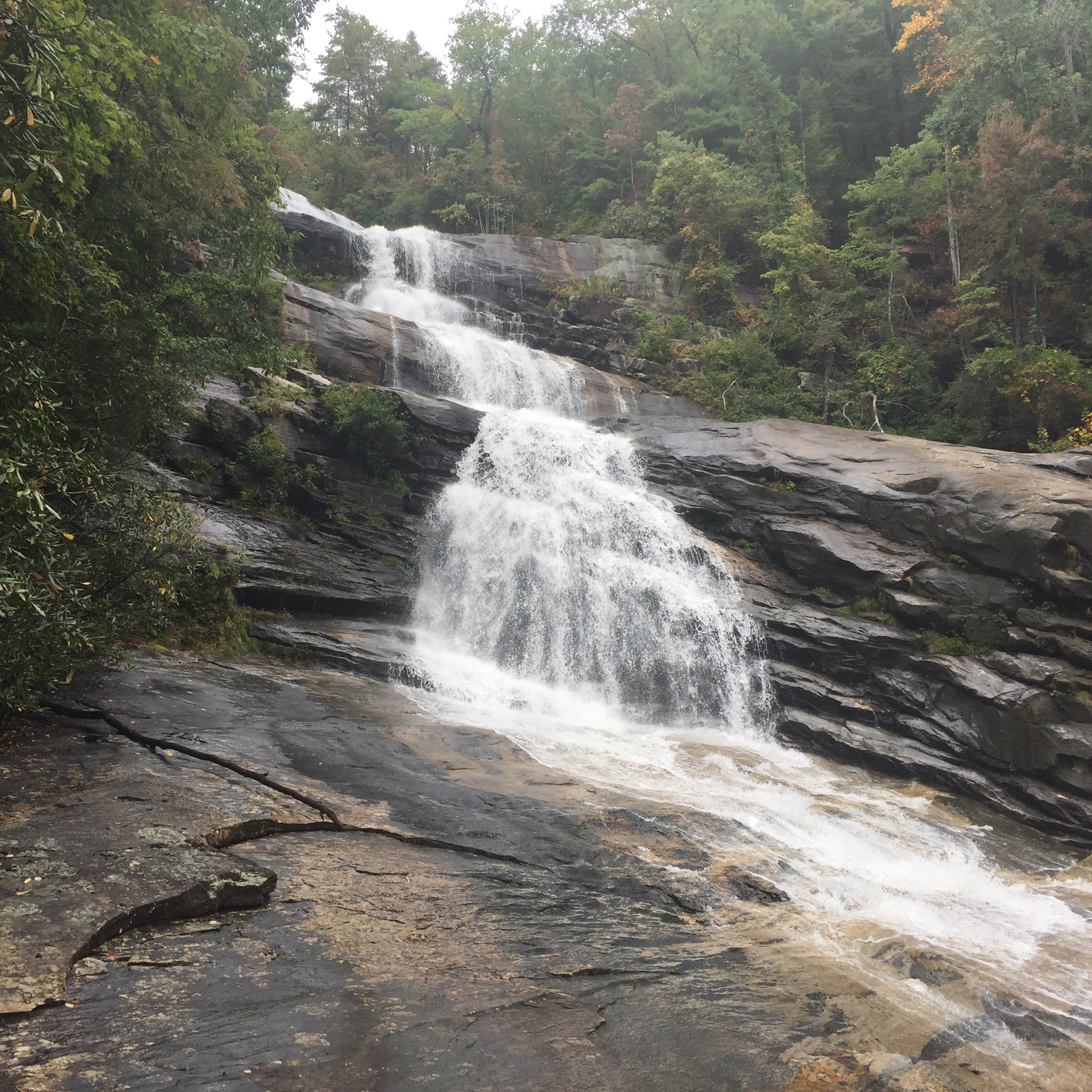
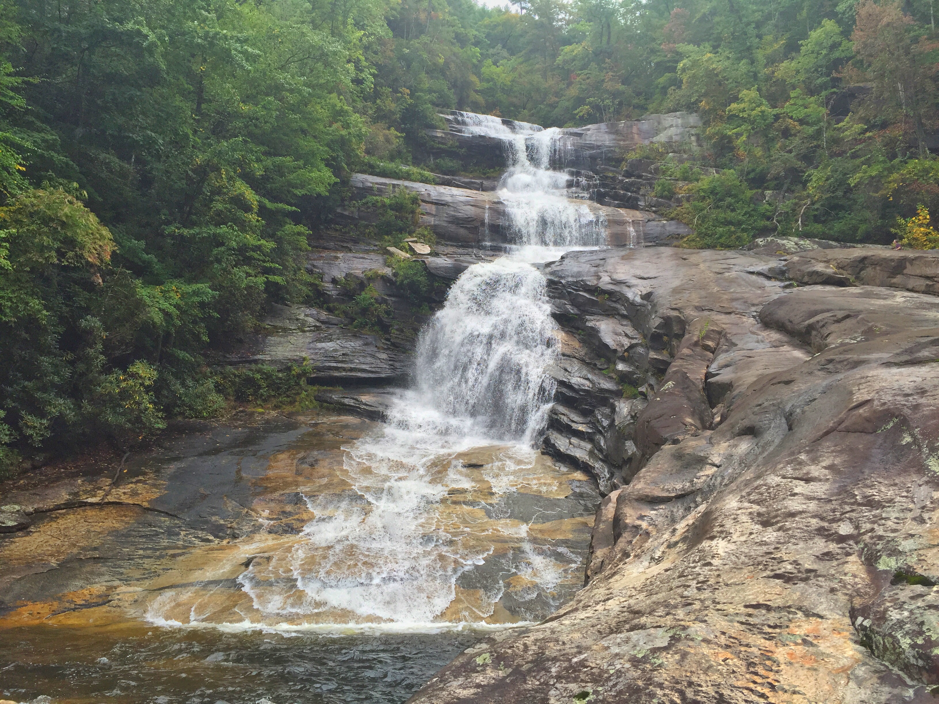
Here are a few Big Falls photos from my Canon:
I was able to take video from several places and make them into one.
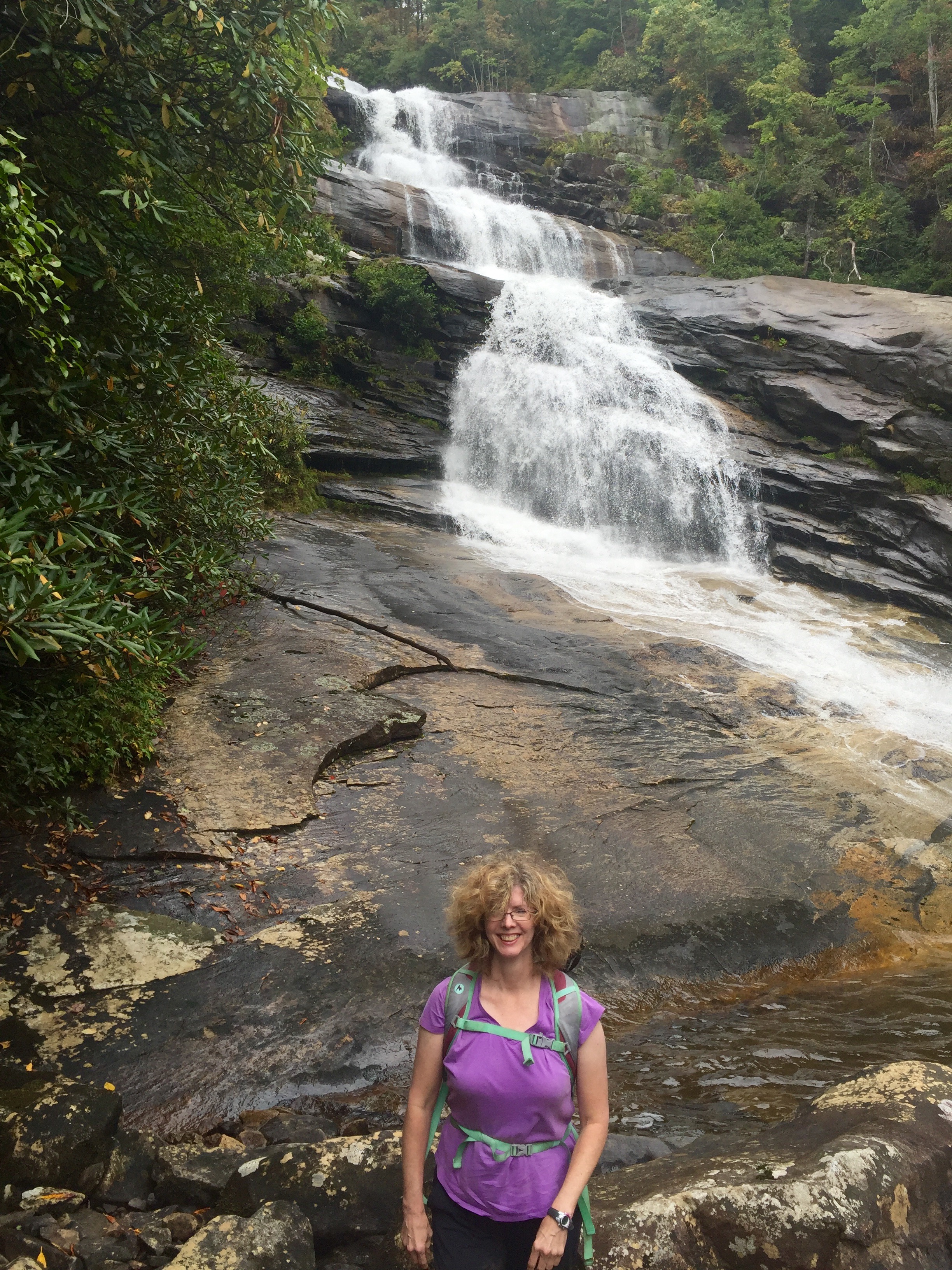
Eventually, we knew we had to leave. As Mark and I were discussing the amazing views from the rock, a light rain began to fall which made Mark and I scurry off that large rock quickly. The rock is not a surface that you want to be trying to climb up or down on when it is wet. Before we began the trek back up, Mark took his usual group photo. Here it is, plus a nice shot that Beth took of us while we were on the rock. I returned favor and got one of her at the base of the falls.
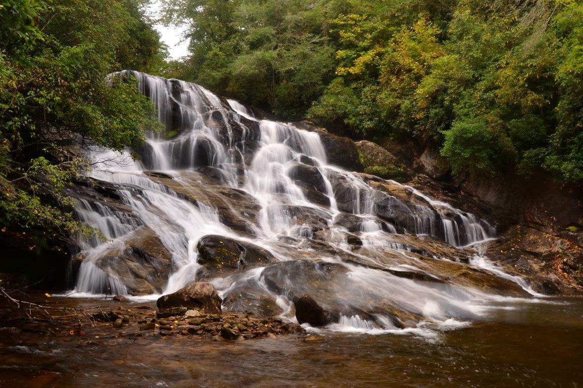
We had a good time down here, resting, taking photos, enjoying lunch, and just having a great time. It was such a job getting here, that I hated to leave. However, the climb back up that must be made was weighing heavy, plus the 3 miles or so back to the car from there. It was not even close to being as difficult as going down, but it was more tiring. Beth and I stopped a few times. Mark went on, but Beth had the keys, so I was safe..lol. I was happy to see to main logging road again. The 3 mile stroll seemed more difficult going back as the miles were piling up and the energy draining out, and the road now being a slight incline vs a slight decline. We got to the point where the trail for Waterfall #2 was and Mark wanted to head down. I did too, but was just too tired. We took a break while he went down. I want to see this too, and will be back for more Thompson River exploring. Just when Beth and I began to worry about Mark..aka the “Moss Ninja” being in some trouble, he appeared. He raved about how nice it was. Here is a photo of the estimated 75 ft waterfall #2 or Rich’s Falls taken by Mark Lackey!
The rest of the hike was tiring and uneventful. I used the river at the crossing to wash some of the dirt off, as we were all filthy after this hike. More advice….bring an entire change of clothes and shoes. There was definitely a feeling of accomplishment once we reached the car. After a quick stop in Gorges to clean off, we had our usual Hiker Grub at the Square Root in Brevard.
The food was good as usual, and it was a nice end to a super hiking day, that I will not soon forget, Thank you again Beth and Mark for hiking along showing me the way to Big Falls! It feels great to cross this one off the “to do” list and add it the “waterfalls visited” list!
Chris
Very good post. Great pics and I especially enjoyed the video. Also feel better with you hiking with others.
Your pictures and narrative of this hike were excellent. Have been to High Falls a couple of times, but haven’t found anyone willing to go to Big Falls. The steep climb out gives me concern.
Thank you very much for the report. We did this hike this past weekend and hit all the major falls along the trek. Very exhausting. A few comments: We were hiking in to camp overnight and were looking for the campsite that you mention. The campsite(s) are actually AFTER you do the river crossing. We did find one very small site before the crossing that hadn’t been used for years, but it is not the one in the photo. There are two very good sites immediately after the 1st river crossing. A nest of yellow jackets was in a tree in the middle of the first campsite, so we went on the the second site, which is a short walk downstream from there. We did not see any additional suitable places to camp the entire way after these sites to Big Falls!
Just hiked the Thompson River to Owl falls, Fall on Reid Branch, High Falls, Big Falls , Water fall #1 & #2 this past weekend!! Awesome trip!!
*! BUT Couldn’t find the path to the #3 Fall right above Big Falls! Any help on this???
I have not been to the Waterfall #3 myself. I would get the latest edition of Kevin Adams “North Carolina Waterfalls”. He does describe how to get up to Standing Stone Falls from Big Falls, or down to it from Rich’s Falls or what used to be Waterfall #2. Just to let you know, he also describes it as possibly the most dangerous waterfall in his book that includes nearly 1000 waterfalls.