Dismal Falls was amazing! It’s hard to imagine someone naming a waterfall “Dismal Falls”. Why would anyone want to see something “Dismal”. Well, Dismal just happens to be the name of the creek that this amazing waterfall lies on, hence the name “Dismal Falls”. I was fortunate enough to visit 2 waterfalls named “Dismal” in 2015. The first was a 15 foot multi-level cascade in SW Virginia near the Cascades, which was very easy to get to. Then, there is this one in the Panthertown Valley region of North Carolina. The difficulty goes way up with this one, but so to does the reward. Jim Bob Tinsley wrote in his legendary book “Land of Waterfalls” ….”One of the most foreboding places in the Southern Appalachian Mountains is Dismal Creek in Transylvania County”. That alone is enough to scare most people away, and certainly worth taking note of….for those that are not.
I have seen this waterfall described as anywhere between 150 -200 feet from notable sources. I can just tell you it is a long, tall set of drops in which the water falls numerous different ways, making for an incredible scene. The hike up to the edge of Dismal Gorge and the insane rope assisted descent certainly put this hike way up there in the strenuous category. At this point, I have to ask myself a question…….Was it worth the 4-5 mile round trip that included very steep climbs and descents that were rope assisted???..Absolutely,….without a doubt. Like I have already mentioned that this was an incredible waterfall and, as a bonus, the hike to Dismal Falls passes by 3 other waterfalls as well. Aunt Sallies Falls, Trailside Falls, and the beautiful Rhapsodie Falls. There are 2 waterfalls on the Carolina Mountain Club’s Waterfall 100 list here: Dismal Falls, and Rhapsodie Falls (West Fork French Broad River Trib….Rhapsodie sounds much better). When all was said and done, on all of the hikes I have now done, I placed this hike’s difficulty level just shy to the hike to Big Falls on the Thompson River, mainly due to Big Falls being longer hike.
(Christi Tramell, Daniel Jack Hutchison, Betty Barton, Me, Mary Gavlik,Beth Bradshaw)The first suggestion, and the most important advice I can give for this hike in particular, is to go with someone who has been here before, someone who knows the challenges, dangers and the many turns required for this hike. There are no signs posted or official trails describing how to get here. Even if you are lucky enough to find the trailhead and place to park, there will be many opportunities to get lost here, not to mention the risks of climbing into and out the the Dismal Creek Gorge.
This hike began with a crew that contains some of the most active waterfall hunters out there. Mary Gavlik, Beth Bradshaw, Christi Tramell, Daniel Jack Hutchinson, and Betty Barton. I have been hiking with most of these guys and gals since the summer of 2015 when I made my initial hike with them at South Harper Creek Falls in Wilson Creek. The job of leading us today belonged to Daniel Jack Hutchinson, who had been here before and was more than happy to lead us there. It’s worth mentioning that it was great to have Christi along as well, who also knew how to get here and was there for that moment or two when Daniel had an uncertain turn moment…..lol
Trailhead To Dismal Falls First job here is finding the trailhead. I can not remember the exact mileage. My phone’s GPS is saying 5.4 miles heading north on NC 281 from the US 64/NC 281 split. Just past the 2nd intersection with Slick Fisher road is a sign for Trails Carolina. The iPhone shows this as Blue Ridge Rd, but i do not remember a sign being there. Look for the Trails Carolina sign for certain. Once there, follow this short road then a side dirt road branches off to the right, which led a short ways to the dead end parking area. The trail starts just beyond the gate.
Off We Go!
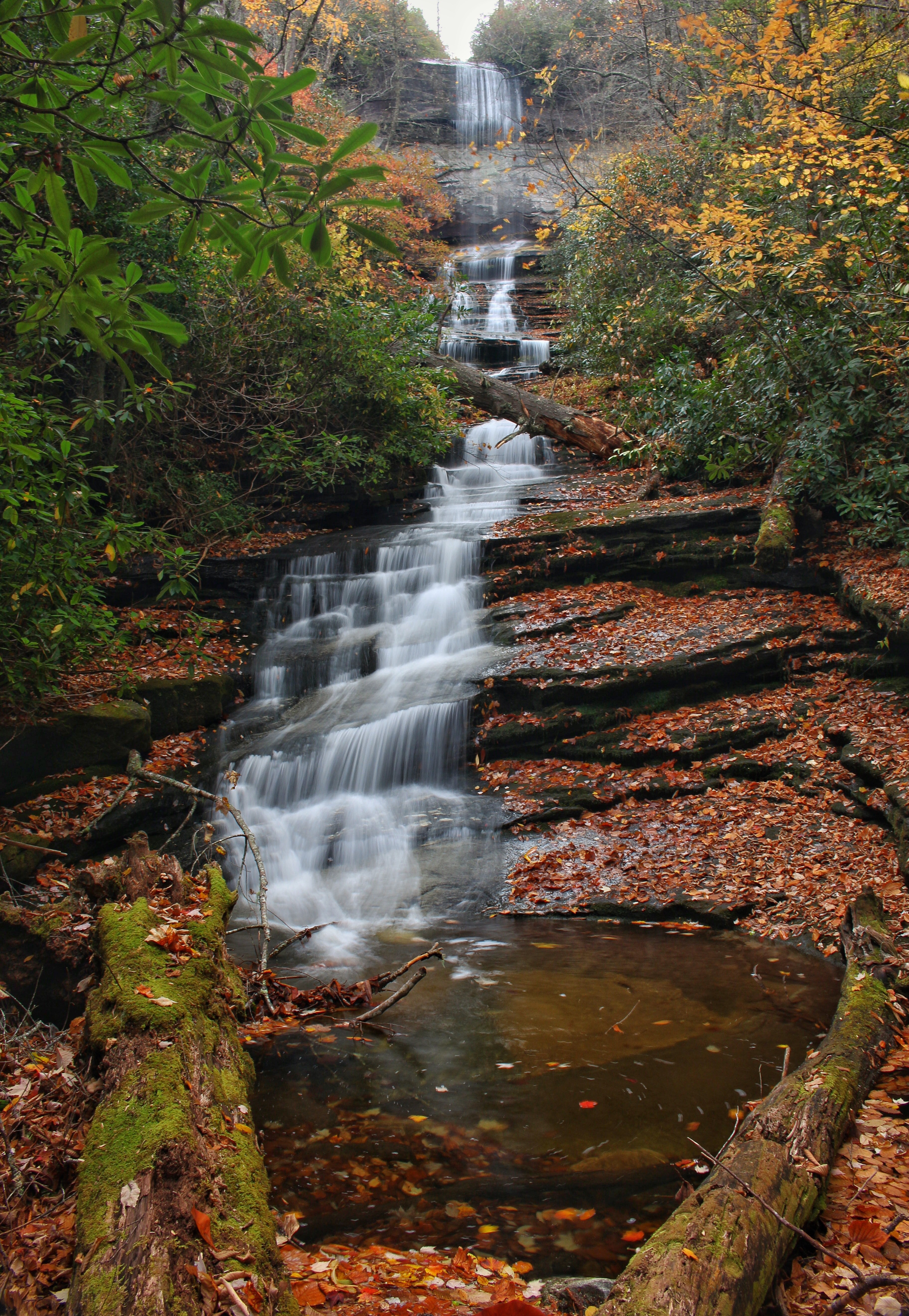
The Group Enters A Beautiful Pine Forest The first part of this intimidating hike was just a beautiful walk in the woods. The trail made its way through some tall pine forests, then areas of rhododendron. It was also late October, and the fall foliage was at or just past peak. It was a cloudy, mild day….really a perfect day for this hike. One of the first points of interest that we would see today was Aunt Sallies Falls. This is a 25 foot fall on a very low flow stream. It is just a short side trip off the main trail.
This Shows The Split For Short Side Trail To Aunt Sallies Falls
Aunt Sallies Falls From here , back to the main trail and on towards the West Fork of The French Broad River. Some power lines had to be walked under. Normally, power lines wouldn’t catch my eye, but this view showed 2015’s fall colors off very well.
Power Line Clearing W/Lots Of Color
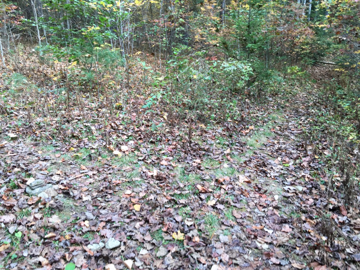
Pink Flagging Tape Roughly Marked The Route
West Fork French Broad River Soon we were at the West Fork of the French Broad River….more like a creek here. This is close to the halfway point and also where the easy walk in the woods ends. On the other side of this river, the terrain begins to climb, slowly at first. A tributary stream must be crossed as the climb begins. A nice 30 ft waterfall is just above this crossing. In Todd Ransom’s book “Waterfalls of Panthertown Valley”, this one is referred to as “Trailside Falls”. Crossing below Trailside Falls can be a little slick as one of our group can attest to. Luckily this person was not injured nor was her camera.
The Group Arrives At Trailside Falls
Trailside Falls After Trailside Falls, the climb intensifies. After some climbing another waterfall soon appears.
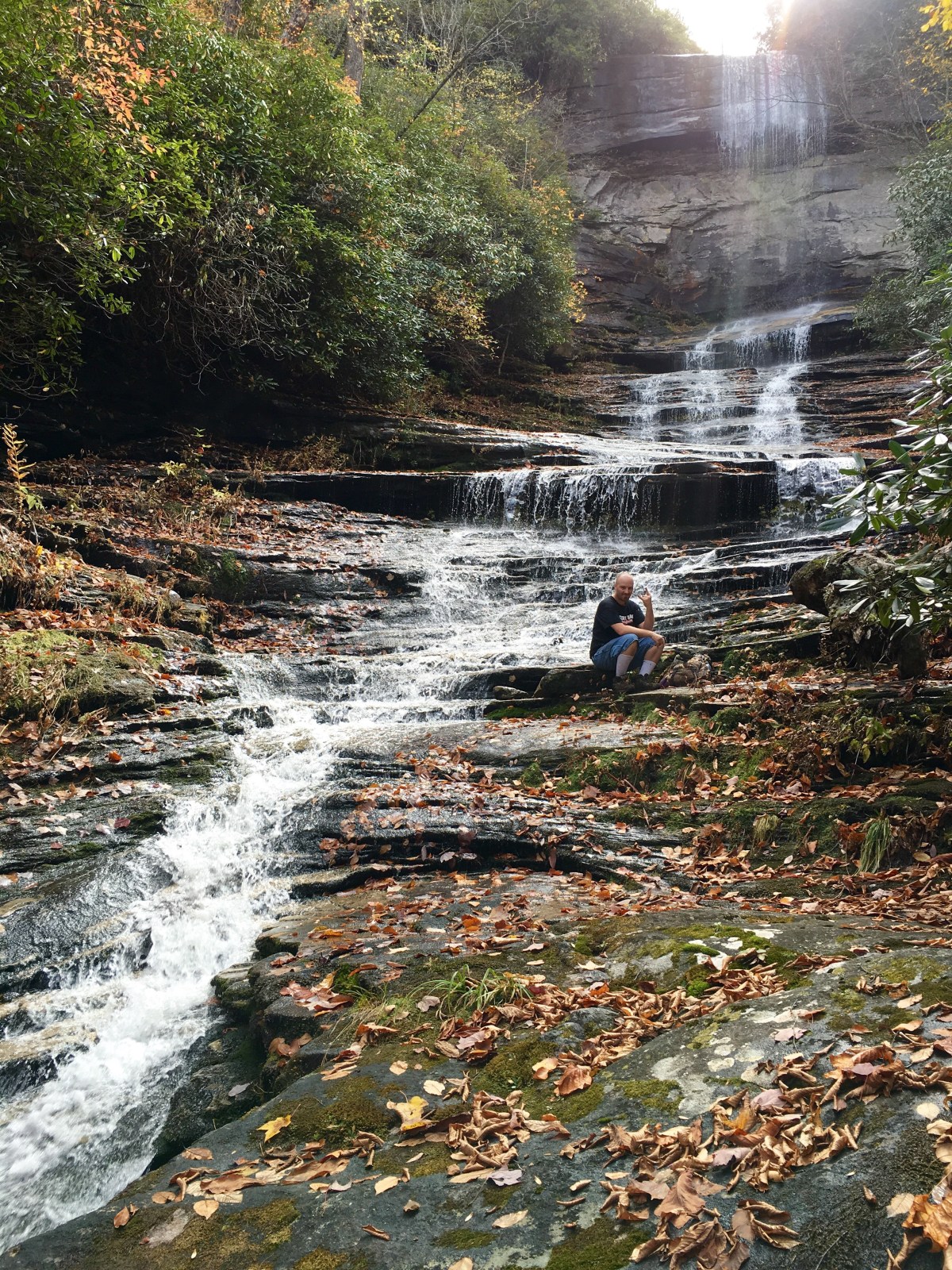
First View Of Rhapsodie Falls From Downstream Getting here was a little tricky as the trail seemed to cross this little stream several times, and at one section, was just going right through it. After leaving the creek and making our way through some very interestingly shaped rocks, a very nice 70 foot free falling waterfall appeared . This one is on the WC100 known simply as the Waterfall on the Tributary of West Fork French Broad. Waterfall Rich named it better as Rhapsodie Falls. Our fearless leader Daniel…seemed to have a little trouble rolling the R sound and decided to just call it Bohemian Falls. The group randomly quoted Queen lyrics the rest of the day! Is this the real life? Is this just fantasy? Caught in a landslide, no escape from reality…..anyways….we stayed here for awhile , took some photos and and a deserved break.
Bohemian Falls
Rhapsodie Falls The last shot here shows Christi, chilling and enjoying the falls. I would love to see this one right after some significant rain. After this nice break, off we went. We came to a fork where heading left may have been the way to the lower waterfall on Dismal Creek. Dismal Falls was to the right. Daniel had a moment of doubt here, and Christi took over, she was leading this hike., she was the captain now….lol. The climb really intensifies after Rhapsody, A well worn path covered in very slick fresh fallen leaves made for a very challenging climb. The foilage was very pretty in this area, but I was huffing and puffing too much to care about it at the moment.
Amazing Colors
The “Death March”….as Daniel Jack Describes It I stayed back just to try and show the scale of this climb. It looks steep here but not half of what it actually was. Daniel Jack described this section of the hike as the “Death March”. It was a long, extended climb straight up the mountain. After the steep climb, and a few slips on the slick leaves later, we reached the top. We still were not at Dismal Falls, but closer. The trail veers off to the left here and enters the Dismal Gorge. The steep climb is replaced by an even steeper, long descent. Ropes are essential here and as of October 2015, there some well placed ropes in mostly decent shape. One was noticed to showing some wear. I would not want to make this drop without the ropes.
We Enter Rope Land
Mary Managing The Descent Quite Well
Daniel Looks Back Up As If To Say “My Dallas Cowboys Suck”..lol
Mary Smiles, Knows A Tough Section Is Just Ahead
Christi Reaches Out To Help Mary Down Once down, we made our way accross some tricky deadfall, and came out onto Dismal Creek in the middle of the falls. it was beautiful!
Daniel, Betty, and Mary Getting Shots Of Upper Dismal
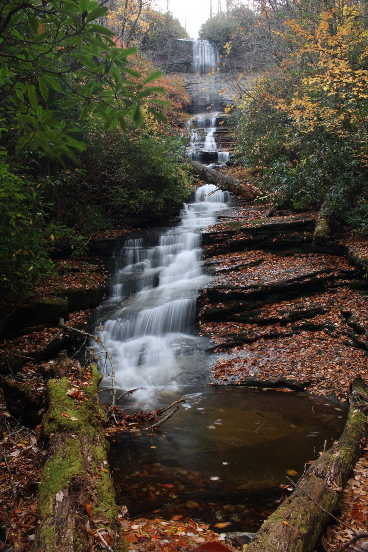
Dismal Falls – Upper Section
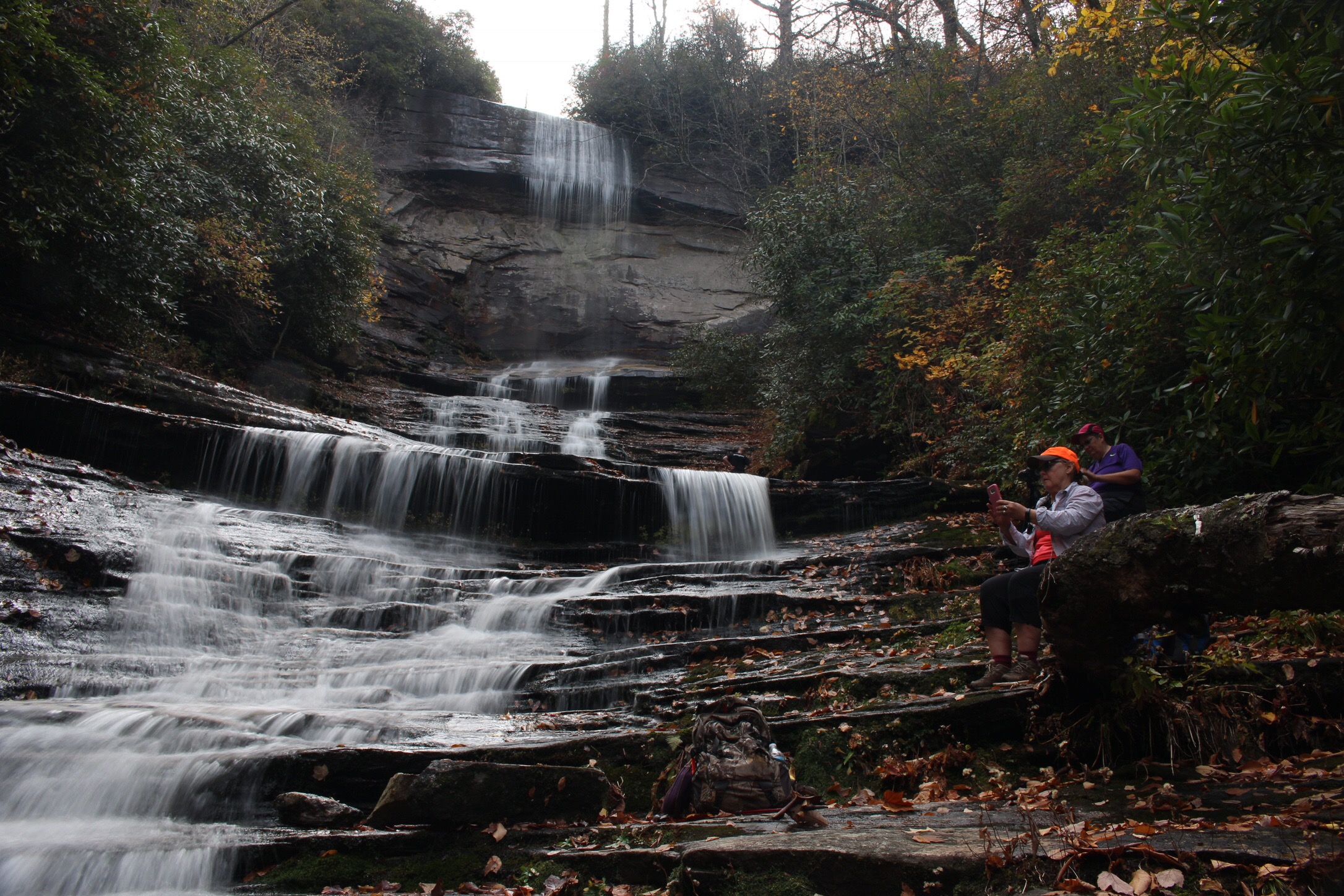
Daniel Jack…A True Waterfall Ninja Beth had left us and made her way on down to the base, so we backtracked accross the deadfall and skimmied on down to the base for the full view of Dismal Falls in all of its October glory!
Dismal Falls From The Bottom…Incredible!
Dismal Falls…Top Section
Mary, Taking A Break, Checking Facebook….LOL
Dismal Falls Top Section, Focusing On One Of Many Individual Drops
Very Picturesque!
Daniels Last Moments W/Dry Feet! Daniel has a habit of cleaning the falls before a photo. There are risks involved with this. I would love to say Daniel got the good shot, cleaned the waterfall , and stayed dry here. 2 out of 3 ain’t bad!! He did get a good shot and cleaned the waterfall…Lol
The return trip was fun. After we all made the steep, rope assisted hard climb out of the gorge, rest was in order for us all. Then the climb down the Death March. This descent on slippery leaves was more difficult than the initial climb. A couple in the group just chose to butt slide down, yelling wheee! That seemed to be the way to go as I had a number of near falls, and finding my tail on the ground twice myself, while trying to navigate this. We stopped at Bohemian Rhapsody Falls on the way back for a group photo and then made our way back. Here is the map from an App on my cell phone showing roughly the path we took.
This crazy hike ended up being roughly 4 miles. It was definitely one of the toughest hikes I have done, but also most rewarding. We ended up seeing 4 waterfalls, some great fall color and just had a great time.


")


